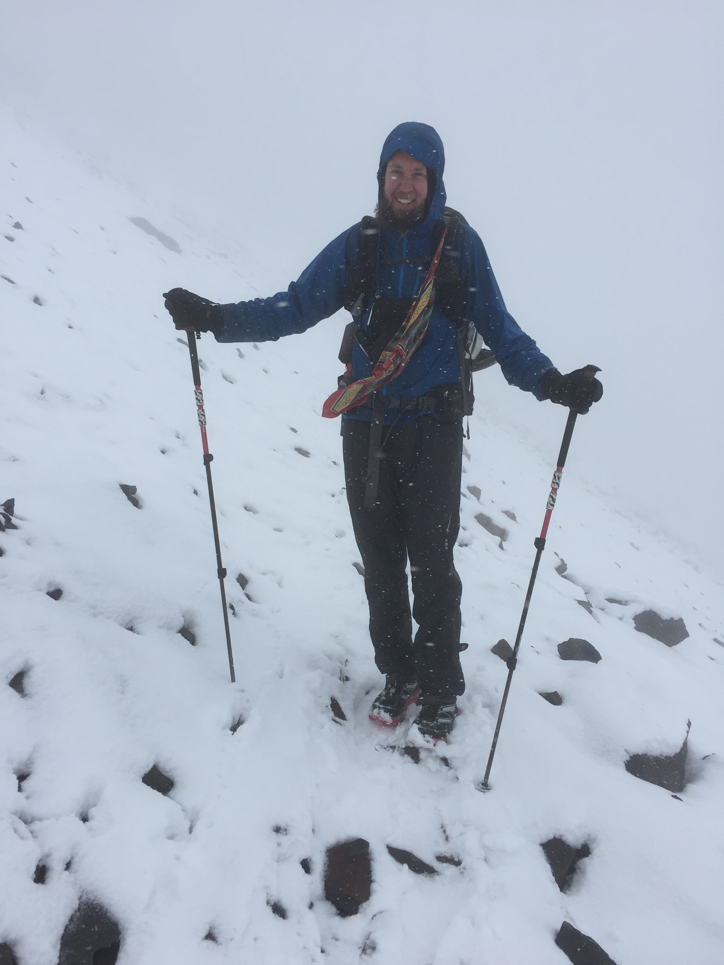
The hail blew against my face so hard it felt like I was getting sandblasted. The wind made a racket blowing the fabric of my clothing, and I tried hard to just put one foot in front of the other, watching carefully to see where rocks stuck out of the snow. On one side of the trail was a thousand-foot dropoff into a valley…and on the other side of the trail was a thousand-foot dropoff into a different valley. When I picked my head up and looked around, all I could see was white — white from the clouds and white from the snow, sometimes blending into each other so well that I literally could not tell where the horizon was.
This is the Knife’s Edge, a long hike across an exposed high ridgeline here in the Goat Rocks Wilderness. But it isn’t supposed to be like this. The Knife’s Edge is famous for its spectacular views of the mountains around Goat Rocks, and typically hikers cross it in pretty good weather — maybe a little rain or fog, perchance, but certainly not snow, and definitely not wind-whipped hail. Yet there we were today, fighting our way across it, managing to both get pelted by all kinds of bad weather — and get to see absolutely nothing, because the clouds and fog were so thick.
In other words…it’s been a crazy, crazy day. After hearing last night that the clouds had cleared off, I had high hopes that maybe today would be sunny — a huge victory, since we crossed what’s widely known as one of the single most beautiful parts of the PCT today. But then I woke up and looked outside, and there was fog everywhere. I had hopes that it’d burn off, but that was not to be so, either. As we started our climb into the heart of the Goat Rocks Wilderness, we did see the clouds part for just a moment, long enough to prove to us that there really are some amazing mountains out there. We got a second quick showing late this afternoon, too, but that was to be it for the day.
The weather, too, has been freakish. Even after the constant rain of the past week, today seemed to top it all. It was 35° when we woke up this morning, and it only got above 40° for a few hours in the late afternoon. In other words: it’s really, really cold. It’s Saturday of Labor Day weekend, which means there are scads of weekend hikers about — but far fewer than there otherwise would be, given how cold and rainy its been. It was a huge relief to me today to hear two separate groups of native Washingtonians, when asked if this weather was typical, answer with an immediate, emphatic “No!”. This means perhaps it’ll change soon.
(As a side note: one of the fun things about having lots of weekend hikers about is that you more often run into people who’ve never met through-hikers before, and thus are easily impressed. One of the groups we ran into consisted of two fairly young couples; they asked us for directions, as they apparently were attempting a cross-country, off-trail journey to a local lake, but got turned around trying to get there. At one point, one of the guys asked us: “Where are you headed?”. The response, of course: “Canada”. That seemed to impress them a fair bit. But when one of the guys asked us: “So, where’d you start?” and I got to answer with “Mexico”, their jaws dropped. I got to instantly far out-macho the already-macho guys in the group, which was an awful lot of fun.)
This area really is beautiful, especially with the snow, but we’ve been able to see so little of it because of the weather. We’re halfway-seriously already making plans to come back here next year on a week-long-ish backpacking trip, just to see all this great stuff that we’re having to miss right now.
We did, however, get two pieces of really good news today, when we got cell-phone service for a brief time. One was just checking the weather report, which, while it continues to show three days of rain coming up, also shows it getting sunny and much warmer for a long stretch after that — hugely exciting for us, who are now on day 8 of rain since entering Washington.
The second, much more important piece of news was an initial indication — and from a fairly reliable source, not the PCT rumor mill — that the closure of the PCT up north from a fire has finally changed, and the trail’s back open. This is huge to us. As you know, we’ve worked incredibly hard to do every single mile of the trail and keep a continuous footpath all the way from Mexico to where we are. This closure, though, had for quite a while either zero alternatives (beyond hitchhiking to get around it, thus skipping about 30 miles of trail) or only one alternative — a 100+–mile road walk far, far around the closed section, something that sounds so unbearable as to be almost not worth considering. Now, however, it looks like we just might actually be able to keep up our walk and make it all the way to Canada, having missed none of the trail at all!
[alpine-phototile-for-flickr src=”set” uid=”44265343@N00″ sid=”72157659385287435″ imgl=”flickr” style=”gallery” row=”5″ grwidth=”800″ grheight=”600″ size=”500″ num=”30″ shadow=”1″ border=”1″ align=”center” max=”100″]
Leave a Reply